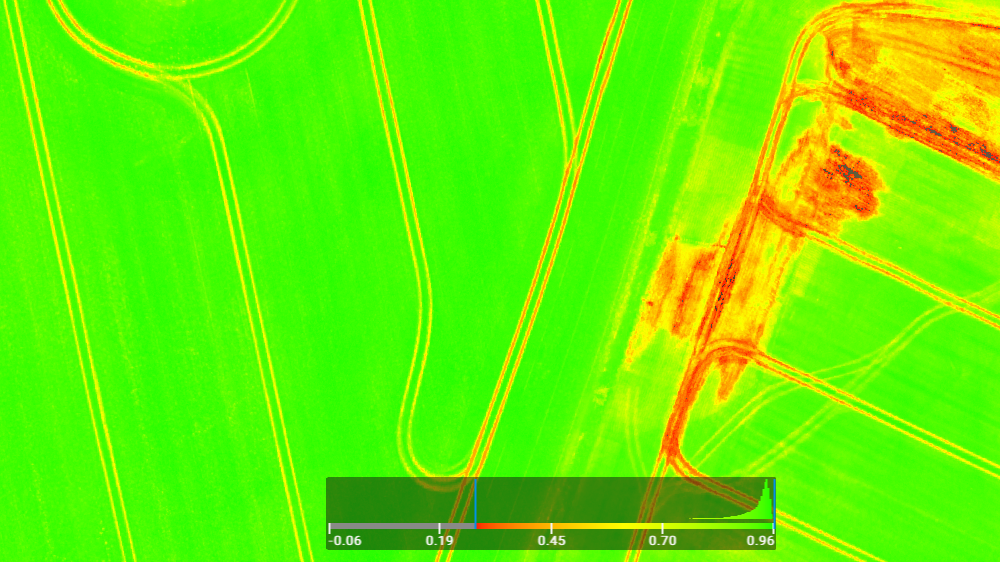
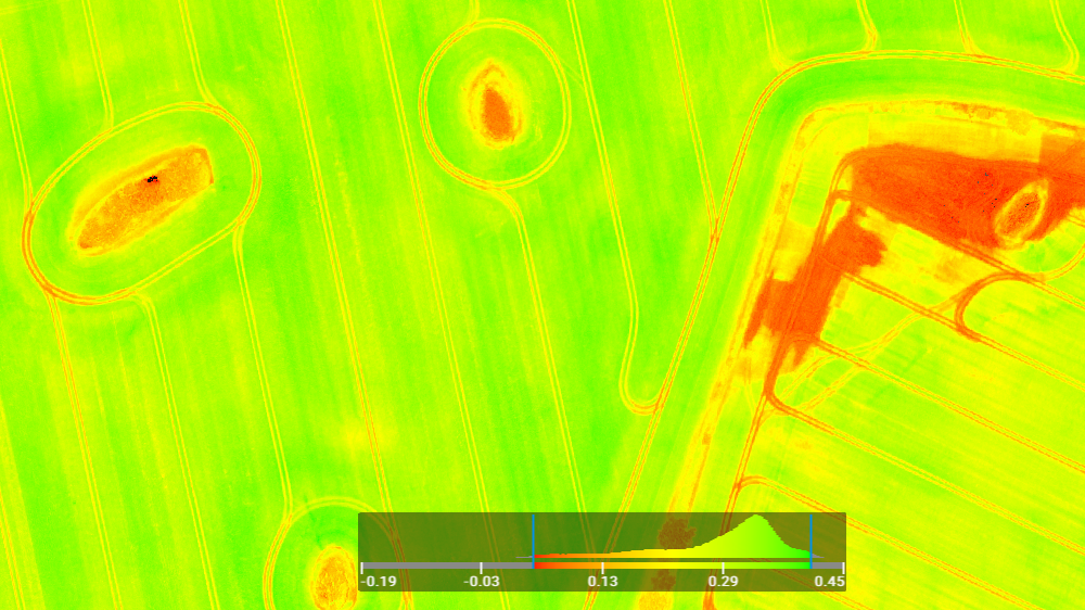
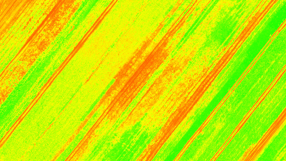
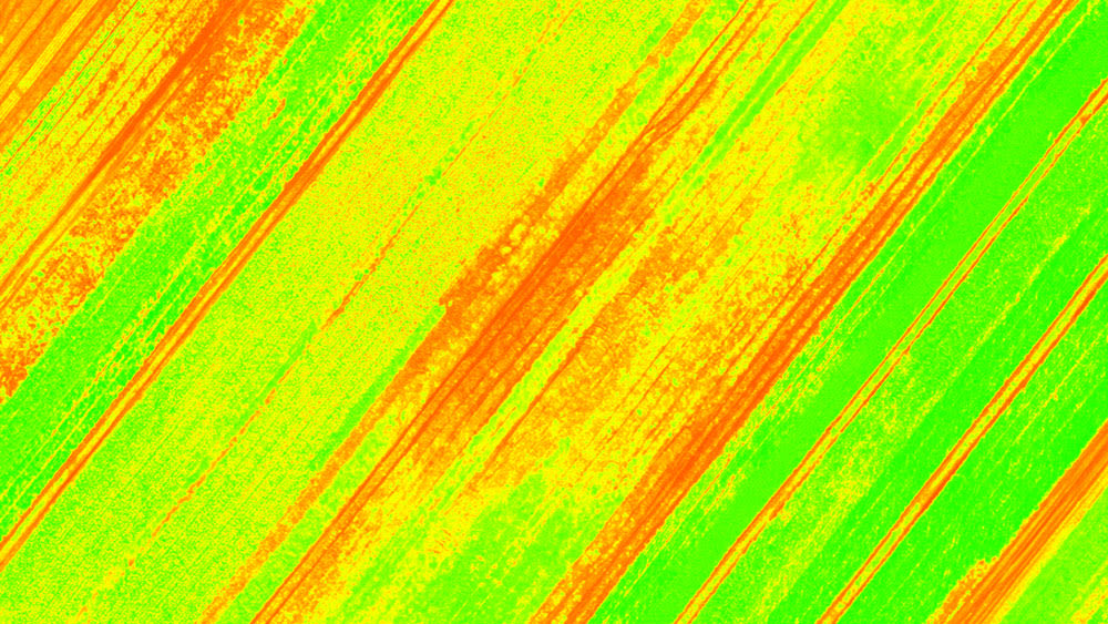
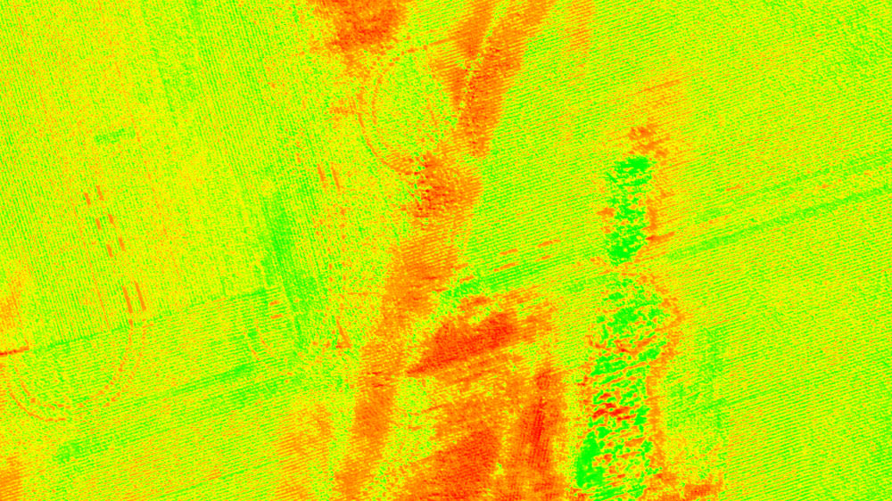
NDVI - Normalised Difference Vegetation Index
NDVI is used to measure the difference between visible and near-infrared light reflectance from crops and other vegetation to provide a standardised view of the strength of photosynthetic activity.
Farmers today face increasing commercial and regulatory pressures to maximise yields while minimising resource consumption. With arable land becoming scarcer and input costs rising, precision agriculture is no longer a luxury—it’s a necessity.
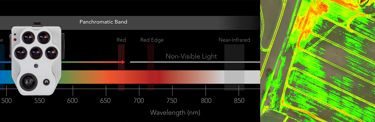
Drones equipped with multispectral sensors are leading the way in agricultural innovation. By capturing high-resolution data across multiple wavelengths, these sensors provide critical insights into crop health, soil conditions, and water distribution. This allows farmers to:
Traditional crop monitoring methods can be time-consuming, costly, and often lack precision. With drones, farmers gain:
🚀 Speed & Efficiency – Cover large areas in a fraction of the time compared to manual scouting.Our UAV services provide high-quality aerial assessments tailored to your farm’s unique needs. Whether you manage a small farm or a large-scale agricultural operation, we help you harness the power of drone technology to increase efficiency, reduce costs, and maximize yields. Contact us today to learn how our drone solutions can transform your agricultural operations!
| Map Vegetation Health using Vegetation Indices such as Normalised Difference Vegetation Index, Optimised Soil Adjusted Vegetation Index and the Normalised Difference Red Edge. |
| Detect Disease by using Multispectral Sensors to measure small changes in crops over time. |
| Determine the Adequacy of Irrigation and Water Management strategies. |
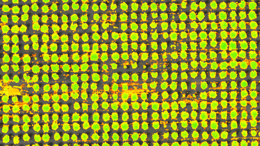
| Classify Plants and Differentiate Species; using size, species, chlorophyll content, and canopy closure. |
| Count Plants using back office analytics fed from captured multispectral data. |
| Determine Crop Damage and assist with preparing Insurance claims. |
| Detect and Map Weed infestation. |
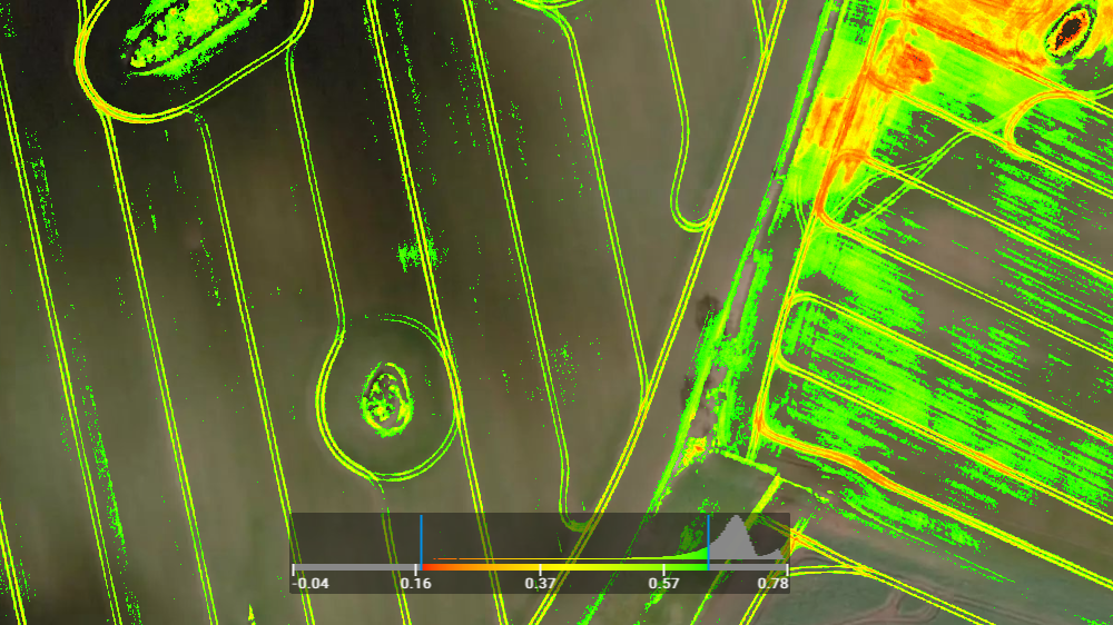
| Understand Drainage Patterns across fields using the Normalised Difference Red Edge Vegetation Index (NDVI) in conjunction with terrain modelling. |
| Reduce the Cost of Labour by capturing full field information rather than having to walk fields for the same intelligence. |
| Monitor Fertiliser Requirements and reduce crop cost by focusing on Precision Agriculture techniques to apply only what is necessary. |
| Perform Analysis Over Time producing artefacts which facilitate analytical workflows rather than relying on memory. |
| Monitor and Detect Nutrient Deficiencies before they impact crop value. |
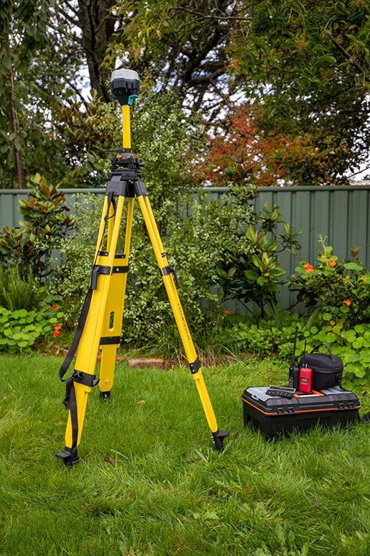
EMLID RS2 GNSS Survey Equipment
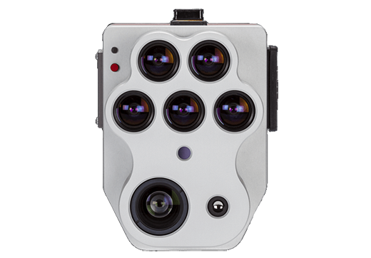
Micasense Altum-PT Multispectral Camera
CSIRO presents the challenge of Precision Agriculture as a "Need to produce more with less". Whether it is determining the volume of pumpkins that you will need to transport to market, minimising herbicide and pesticide usage by accurately identifying areas of poor growth, or mapping drainage across fields, UAV technology is able to assist and PHIRE-1 Solutions Pty Ltd is able to help you on that journey.
Our Integrated approach is tailored to your specific needs. Typically :
NDVI is used to measure the difference between visible and near-infrared light reflectance from crops and other vegetation to provide a standardised view of the strength of photosynthetic activity.
NDRE is sensitive to chlorophyll content in leaves, variability in leaf area, and soil background effects. High values of NDRE represent higher levels of leaf chlorophyll content than lower values. Soil typically has the lowest values, unhealthy plants have intermediate values, and healthy plants have the highest values. Consider using NDRE if you are interested in mapping variability in fertilizer requirements or foliar Nitrogen, not necessarily Nitrogen availability in the soil.
OSAVI is a variant of the Soil Adjusted Vegetation Index (SAVI). OSAVI has a soil-adjustment factor of 0.16; which results in an improved index for use where soils are highly reflective of Near Infra-Red light (For example, soils that are high in silica). OSAVI is particularly useful for stand counting of young trees in areas where there is significant soil exposure.
TGI is an RGB index for chlorophyll sensitivity. TGI index relies on reflectance values at visible wavelengths. It is a good proxy for chlorophyll content in areas of high leaf cover.
VARI is an RGB index for leaf coverage. This index is used to estimate the fraction of vegetation in an image with low sensitivity to atmospheric effects.
BNDVI is an index without red channel availability that uses the visible blue, for areas sensitive to chlorophyll content.
GNDVI index uses visible green instead of visible red and near infrared. Useful for measuring rates of photosynthesis and monitoring the plant stress.
MCARI is an index used to measure chlorophyll concentrations including variations in the Leaf Area Index.
We can construct custom index masks for Soil or Vegetation from our maps for more focused results. These can also be used for counting specific items such as plants, trees, fruit etc.