Unmanned Aerial Vehicles
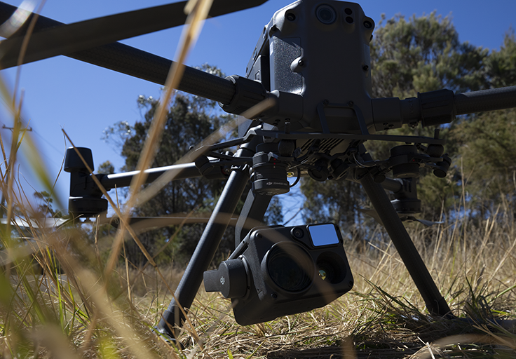
We fly the DJI Matrice M300 RTK which are top-of-the-line Search and Rescue, Commercial and Industrial Inspection remote piloted aircraft available currently.
PHIRE-1 Solutions Pty Ltd is a leading supplier of Unmanned Aerial Vehicle Services to a wide range of industries across NSW. Our staff have more than 35 years' experience in the Australian Aviation Sector. We hold a CASA issued Remote Piloted Aircraft Operators Certificate (CASA.REOC.6547) and each of our pilots is qualified with a CASA issued Remote Pilots License (RePL).
PHIRE-1 Solutions (PH1S) provides a range of services to a wide range of industries, including but not limited to:
PH1S brings a range of high technology solutions to bear for each of our clients. Our extensive experience coupled with our high technology aircraft plus our back-office analytics capabilities ensures that you get the results that you seek at a competitive price.
 |
We fly the DJI Matrice M300 RTK which are top-of-the-line Search and Rescue, Commercial and Industrial Inspection remote piloted aircraft available currently.
Remote Piloted Aircraft are of limited use without high quality Sensors, and we have available the top-of-the-line DJI H20T Quad Sensor, the P1 Orthographic camera, the L1 Lidar and the Micasense Rededge Altum-PT multispectral camera.
We leverage Emlid Multi-band RTK GNSS Receivers for geospatial positioning of our Real Time Kinematic base stations for the ultimate in accuracy from the M300 UAV.
PH1S provides a range of different offerings to meet specific needs. From onsite Multispectral analysis using Pix4d-Fields and QGIS, through to serious number crunching on our server farm we have your needs covered.